

Forth Mountain [Sliabh Fothart]
Good walks are even better shared.
S9819 : Forth Mountain
Richard Webb Photo source
Overview
Forth Mountain [Sliabh Fothart]
Nestled in County Wexford, Ireland, Forth Mountain is more than just a bump in the landscape; it's a hidden gem waiting to be explored. With an elevation of 605 meters, it qualifies as a Hewitt and a Marilyn, providing a respectable climb without the relentless toil often associated with these classifications.
Geology
Forth Mountain is predominantly made of Old Red Sandstone. As you traverse its slopes, you'll witness layered rock formations that tell tales of ancient environments. This geology, while not as exciting as watching paint dry, offers a fascinating glimpse into the Earth's history.
Routes
The most popular route to the summit is the Forth Mountain Loop, a delightful 7.5 km trek starting at the Ferns Castle car park. This moderate route winds through lush greenery and rocky outcrops, ensuring that you stay engaged and entertained throughout the journey. Expect to allocate around 2.5 hours to complete this loop—just enough time to ponder life’s mysteries, from why you stepped outside without your waterproof jacket to the meaning of the universe.
Terrain
The terrain is primarily grassy, with occasional rocky outcrops. While it offers a relatively comfortable walking experience, be mindful of your foot placement in steeper sections. Irish weather can surprise you, so a sturdy pair of boots is your best friend.
Summit Features
Upon reaching the summit, you will be greeted by a modest cairn that marks your achievement. The panoramic views will leave you breathless in more ways than one, with the Wicklow Mountains, the Irish Sea, and the distant Blackstairs Mountains lining the horizon—proof that Mother Nature is quite the artist.
Views
If you're after spectacular views (and who isn't?), plan your hike during late spring or autumn. In these seasons, nature showcases its palette of colours, providing picture-perfect scenery. Don't forget to pack a camera; you'll want to capture these vistas for posterity—or your Instagram feed.
Hazards
Though Forth Mountain is relatively tame, it’s wise to watch out for loose rocks and the odd boggy patch, especially after heavy rains. As the saying goes, ‘there's no such thing as bad weather, only inappropriate clothing’—keep that in mind!
Access
Getting to Forth Mountain is as easy as pie—especially if you know where to park. The closest parking can be found at Ferns Castle, about 5 km away. Bus services from Wexford town are available, but a private vehicle or taxi will get you there more smoothly. The town of Ferns itself is a delightful spot to grab some supplies or grab a bite before or after your adventure.
Facilities
While there are no facilities on the mountain, rest assured that the nearby town of Ferns has plenty to offer. Don’t miss out on the local cafes and pubs—perfect for a post-hike pint or a substantial meal, because nothing says ‘reward’ like carbs after a good walk.
History
Sliabh Fothart, meaning 'Mountain of the Wind,' is an apt name considering the breezy peaks. This mountain carries the weight of local folklore and history, standing as a natural landmark for those who’ve walked its paths through the ages, making it a culturally significant site for the region.
Forth Mountain is not just a hike; it’s a gateway to nature, history, and stunning vistas. So lace up those boots and prepare for a journey that promises beauty, discovery, and maybe a good laugh or two along the way.
Enjoy your adventure!
Explore routes near Forth Mountain [Sliabh Fothart]
Walks starting near this hill. Open a route to check its map, distance and full itinerary.
Route planning notes
These notes describe possible approaches. Check a route's map and access information when planning your walk.
Forth Mountain Loop
A scenic loop providing spectacular views over the surrounding countryside, beginning at the Ferns Castle car park.
Make a day of it, together
Find someone to share the walk with, or organise a day out along a route you like.
Photo Gallery
View all Photo could not load
S9819 : Forth Mountain
Richard Webb
Hill facts and local notes
Classifications
Elevation
237m
778 ft
Prominence
192m
Coordinates
52.3162, -6.5624
S980192
OS Map
77
At the Summit
At the summit, hikers will find a small cairn and a sweeping view of the surrounding hills, which is less of a 'keep right' sign and more of a 'bloody brilliant!' view.
Terrain & Geology
Forth Mountain is primarily composed of Old Red Sandstone, featuring impressive rock formations that have stood the test of time. The layers reveal millions of years of geological history, a stone-age wisdom if you will.
Views & Scenery
Stunning views of the Wicklow Mountains and the Irish Sea, alongside glimpses of the distant Blackstairs Mountains.
History & Heritage
Name Origin
Sliabh Fothart translates to 'Mountain of the Wind,' aptly named considering the gusty companionship you might find at the summit.
Historical Significance
Forth Mountain has played a role in local folklore and history, serving as a natural landmark for centuries and inspiring countless stories among locals.
Getting There & Facilities
Parking
The nearest parking is at Ferns Castle, approximately 5 km away, with ample space and a fitting historical backdrop.
Public Transport
Bus services from Wexford town operate periodically, although a taxi or private vehicle is recommended for direct access.
Nearby Facilities
There are no facilities on the mountain itself, but the nearby town of Ferns has cafes and pubs, where a friendly chat and a hearty meal can help you refuel before or after your hike.
Safety Information
Known Hazards
- Be cautious of loose rocks and occasional boggy sections, particularly after heavy rainfall. The Irish weather can turn quicker than you can say 'I'll just have one more pint!'
General Safety Tips
- Check weather conditions before setting out
- Carry appropriate clothing and equipment
- Let someone know your planned route
- Take a map, compass, and GPS device
- Carry emergency supplies: food, water, first aid kit, torch
Hills
Some common questions about the hills answered
Are there group walks up Forth Mountain [Sliabh Fothart]?
Many walkers use Walkmates to join or organise walks with others. You can check for group walks around Forth Mountain [Sliabh Fothart] through the maps
Are there other walkers around Forth Mountain [Sliabh Fothart]?
Activity varies by location and time, but Walkmates lets you see whether others have shared walks or shown interest in this area. Find other people through the walking friends search walking friends for Forth Mountain [Sliabh Fothart] search or of course create your own walk for Forth Mountain [Sliabh Fothart]
Can I organise a walk to Forth Mountain [Sliabh Fothart]?
Yes. If there aren’t any walks listed already, you can create a walk and make it available for others to join.
If you're signed up to Walkmates, you can create a walk to Forth Mountain [Sliabh Fothart].
How do I find a walk up this hill?
There are often multiple ways to walk this hill, depending on experience and route preference. Walkmates helps you explore walks and routes that others have shared.
Can I suggest a new route up Forth Mountain [Sliabh Fothart]?
Yes. You can suggest or create routes to share with others. Walkmates focuses on the social side of walking, so routes are used to help people organise walks and explore areas together, rather than as detailed navigation tools or route libraries.
Other uses really appreciate knowledgeable walkers sharing their routes. Share your favourite route to Forth Mountain [Sliabh Fothart] here
The is an error or something incorrect about this hill. How do I let you know?
We always strive to keep the information on Walkmates as accurate as possible. If you find an error, please let us know through the contact form and we'll aim to correct it as quickly as possible
Community Discussion
Comments
Location
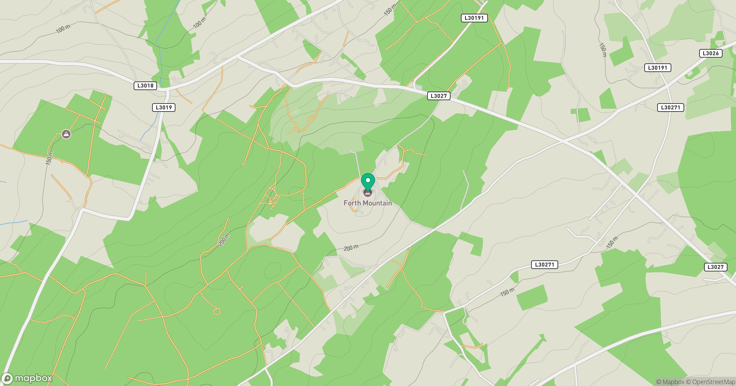
Grid reference: S980192
View on OpenStreetMapOpens a map in a new tab, centred on the hill.
No comments yet. Be the first.